
Mapineq Link: Real-world data for research
We’re excited to unveil our third module featuring cutting-edge geo-located socioeconomic indicators sourced from both commercial and unconventional channels. While the complete report is under embargo, we’re offering you a sneak peek into the concept of real-world data, exploring its potential applications, challenges, limitations, and ethical considerations.
Mapineq Link: two significant steps closer to realisation
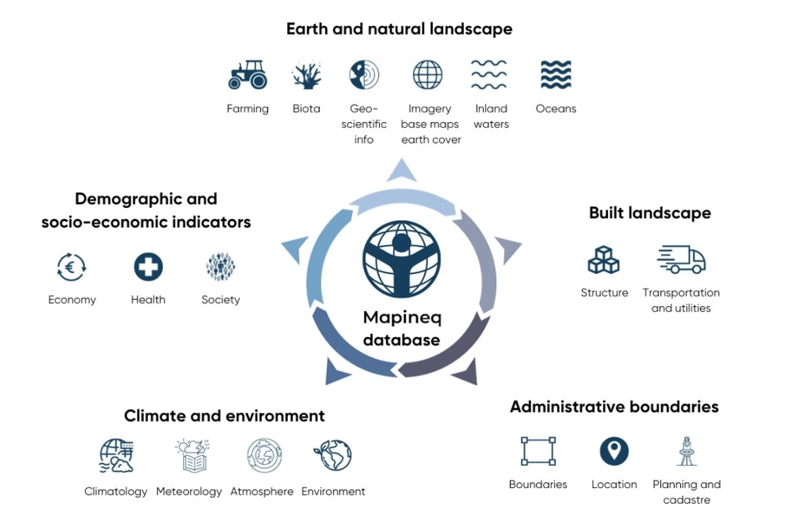
Mapineq has released Phase 1, which covers geospatial social and economic policy indicators, and Phase 2, the physical environmental geo-linked module, of the geo-located inequality database. Data will be accessed programmatically via an API and will also be available for exploration using an interactive, user-friendly dashboard in the future.
UNED hosted a workshop on geo-spatial data analysis
Risto Conte (Max Planck Institute for Demographic Research, Rostok) and Douglas Leasure (Leverhulme Centre for Demographic Science, Oxford) shared novel ways to estimate population values using geo-located data.